Friday, July 23, 2010

Cedar Breaks National Monument

High in the Utah mountains lies the Cedar Breaks National Monument - a less known and little visited gem. At over 10,000 feet in elevation, the park provides outstanding views of a hoodoo eroded amphitheatre. Just East of the town of Cedar Breaks, Utah the monument is easily accessed and best of all free!

Often compared to Bryce Canyon National Park because of similarity in hoodoo views, Cedar Breaks provides its own unique take on this geologic anomaly. A small visitor center exists in a pristine, wild flower covered meadow - and could be one of the friendliest I've ever visited. A small path leads to the Cedar Breaks amphitheatre and the orange, tan, and white hoodoos rising towards the blue sky from its center.

The parks location makes it easy from any parks traveler in the area to make a day stop and take a few pictures as memories of this remarkable, yet tiny National Monument.


Newspaper Rock State Historic Monument

Nestled into a corner of a deep canyon lies some of the most dramatic and mysterious pictographs easily accessible to any Southern Utah visitor. Left up to two centuries ago, Anasazi, Navajo, and Freemont tribes left these wild carvings into the face of a dark faceted rock face.

The monument itself is small, and best of all free! Located along the entrance road to the Needles District of Canyonlands National Park - the park is easy to find. Often there are native vendors set up selling everything from Southwestern style jewelry to decorated pots. A parking lot and a pit toilet are the only amenities available.

The pictographs are closely scratched and pecked into a large dark colored canyon wall - providing a dark canvas for the tan canvases. The images come in all varieties, with everything from animals (buffalo, pronghorn, and horses) to circular shapes and human like beasts with horns. One can spend hours staring at the intricate and often overlapping shapes wondering what the pictographs mean and why they were placed there thousands of years ago


Thursday, July 22, 2010

Moki Dugway

Just south of Natural Bridges along remote Utah State Route 261 is the Moki Dugway - a steep, switchback laden dirt road. Offering an unforgettable sense of remote danger and awesome views of the Valley of Gods below, the road is not for the faint of heart or for those terrified of heights.

The road itself was built back in the 1950's to accommodate transportation of raw materials to a processing plant located in Mexican Hat, Utah. The twist and turns of the road are quite steep and need to be taken slowly. We only encountered only one other car during our decent - another small group of tourists pulled over taking pictures of the vast butte covered landscape of southern Utah.

Anyone traveling the Grand Circle tour should take this less traveled route because of its proximity to Valley of the Gods, Monument Valley, Natural Bridges amongst others. If you go, don't forget your camera and your sense of adventure!


Thursday, July 15, 2010

Goosenecks State Park

Just north of the Arizona/Utah border is a small Utah State Park called Goosenecks State Park. Goosenecks gets its name because of the dramatic bends that the San Juan River has cut through the surrounding rock.

One nice benefit of visiting Goosenecks is that enterance to the park is free. Located just north of the town of Mexican Hat, UT the park sees little visitation much of the year. It consists of downward views of the San Juan river snaking around massive layers of dark colored rock. A vault toilet and a campground exist, although amenities are scare and the park is more of a quick stop over rather than a destination.

During our visit a very nice Navajo woman was selling her jewelry, pottery, and other native wares in the parking lot. Although we did not buy anything, its very common to find Navajo selling tourists souvenirs in the area since the Navajo resevation is located near by.


Natural Bridges National Monument

Remotely located in Southern Utah, Natural Bridges National Monument is a detour worth the time. Hours drive from the nearest city, Natural Bridges offers a quiet serenity that only comes from deep isolation.

A small monument in size, the monument protects three naturally created stone bridges (Sipapu, Kachina, and Owachomo Bridges). A loop above a canyon travels the visitor around to each of the bridges view points, restrooms, picnic areas, and several hiking trails some of which descend into the canyon. Natural Bridges is unique since I know of no other place in the US where there is such a large concentration of bridges in such a small relative area. In addition to the views of the bridges, there is also a pull over to view some old Native American ruins. Make sure to bring your binoculars.

Natural Bridges has been determined to be one of the darkest places in the lower US. Because of its remote location, very little artifical light from cities is found, and thus the night sky becomes ablaze with the stars in the heavens. The campground is a great place to set up a telescope and wonder on the enormity of the Milky Way above.


Tuesday, July 13, 2010

Glacier National Park

Rising from the immense lakes and whispering fog, the mountains of Glacier National Park are some of the most beautiful in the world. Jagged and rugged, sharp points pierce the big blue Montana sky. Nestled amongst the peaks and valleys are the parks namesake features - the glaciers themselves. Not as abundant as 50 years ago, every visitor still has the opportunity to see one of the last great, ever melting wonders of the west.

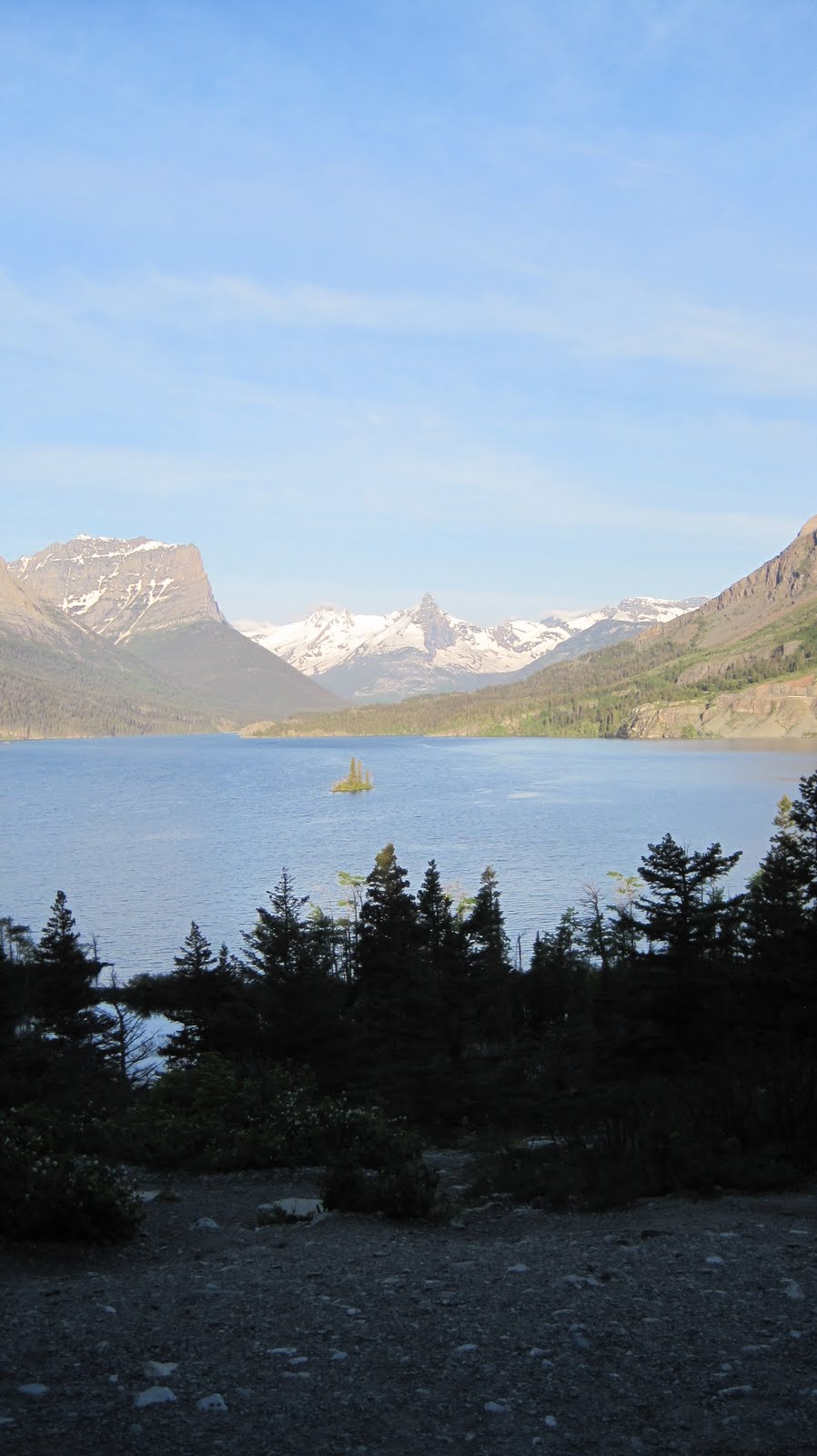
We started our Glacier adventure on the East side of the Park - intending to drive to the West side via the brilliantly engineered Going to the Sun Road. However, even though it was late June, the road was not fully open during our visit and thus we drove and far up on the East side as we could, and as far up on the West side as we could. It's safe to note that each side of the Park are very different. St. Mary's is the best starting point and base for your East side visit. The Park Cafe is excellent as the pie might be the best I've ever had. Also check out Full Quiver Espresso stand for coffee in the morning - fresh and friendly. We camped at Rising Sun and found it to be a great spot to camp. The East side is much quieter and we enjoyed that. On the East side is the famous pull off from the Going to the Sun Road to photograph Wild Goose Island on Saint Mary Lake.

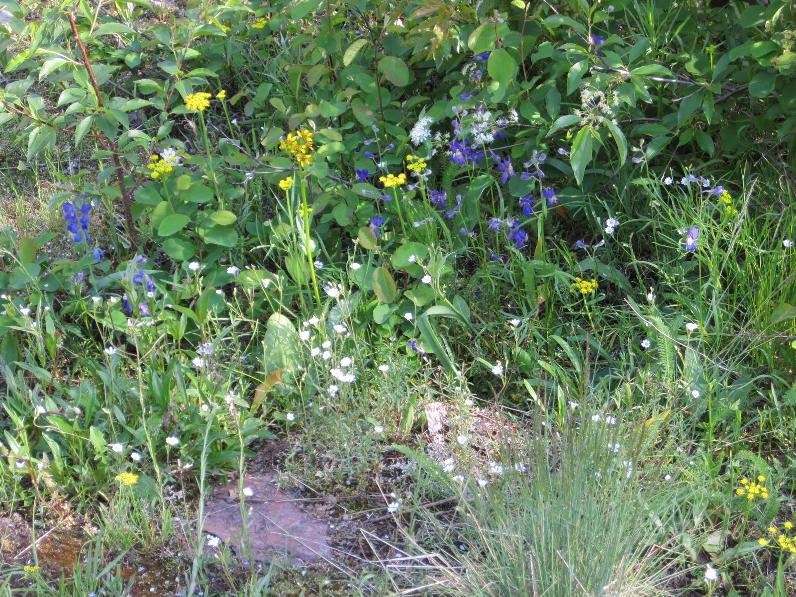
The Many Glaciers area of Glacier is striking in its beauty and charm. We saw a brown bear mother with her cub along the road. Many great hikes start around Many Glacier, however during our visit it had been so cold and because of recent snow many of the trails were closed. Make sure to visit St. Mary's Falls, it was an incredible water fall and a pleasant, strolling walk through the forest down to it.
Spend time to stop at the Sunrift Gorge, a dark crack in the earth where water gushes downstream at a rapid rate. Running Eagle falls in the Two Medicine section of the park is a must see. It's harder to tell why they used to call this "Trick Falls" but if you look closely you can see water coming over the rock and through the bottom.
The Going to the Sun Road is one of the most amazing sights and experiences I've ever had in a national park. It's dramatic views, curvey roads, and steep drops make this one for only the healthy and well hearted. If you dare go up the Going to the Sun Road, be careful and just enjoy it. It will take your breath away.


Glacier is one of those must do parks for anyone who enjoys our National Parks or anyone seeking some outdoor adventure. It's a big park, so take your time and enjoy the fresh air.